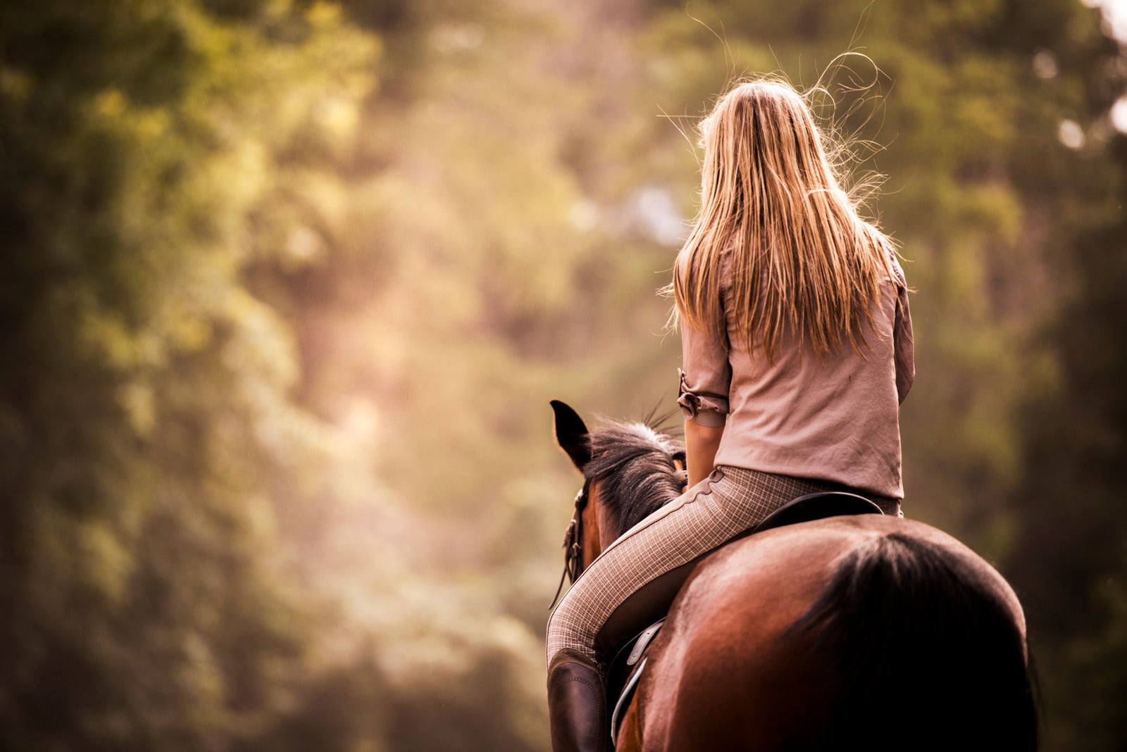
There is no better way to experience the outdoors than on horseback, and Princeton creates the perfect setting for the avid rider. With the availability of rural ranch properties and an active PXA membership combined with activities that range from rodeos to parks and heritage trails, Princeton has emerged into a considerable horse community. Below is just a taste of what the area can offer for all riders.
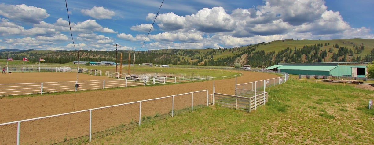
Rodeos, horse racing, a fall fair, horse training, stall rentals: these are all part of what takes place at Sunflower Downs, a multi-purpose facility owned by the Town of Princeton and managed by the Princeton Exhibition Association. The facility consists of a beer garden with a stage and dance floor, a race track approved for thoroughbred racing, a rodeo complex for professional rodeos, a grandstand, parimutuel facilities, an office space, large washrooms, a concession building, stalls, barns, and three multi-purpose buildings suitable for small gatherings. Chairs and tables, along with picnic tables, round out the equipment for rent for events. The PXA grounds consist of 60 acres adjacent to a naturalist park & the Trans-Canada Trail. The availability of trail riding available from our grounds is quite extensive.
Barn Facilities
For the horse enthusiast the Princeton Exhibition Association offers the following:
- Indoor Arena: a full size indoor riding arena, complete with bleachers, a tack room/office with large viewing window, washroom, hot water, benches with underneath lockable storage & a large number of hooks for hanging tack, coats etc. Also inside the arena are 20 box stalls for the safe keeping of horses. The arena has a generous number of overhead lights for your riding enjoyment during the darker hours.
- Outdoor Arena/Rodeo Arena: The PXA offers a full size rodeo arena with all the extras that you would expect to find: Announcer's podium; Chutes, for bucking stock & bulls; chutes for calf roping; Barrels for barrel racing; Poles for gymkana type events etc. The outdoor arena also has pens for livestock conveniently attached to the facility. The outdoor arena is situated in front of our grandstands.
- Round pens: The PXA offers a choice of three (3) round pens in different locations; (a) A round pen is set up just outside the south end of the indoor riding arena, this portable system can be moved to the inside of the arena if certain activities would find this more suitable. (b) A round pen is a permanent fixture on the outside of the northeast corner of the outdoor/rodeo riding arena. This round pen is conveniently attached the the livestock pens in this location. A round pen is also located adjacent to the northeast end of outdoor barn #4.
- Outdoor barns: on the northeast end of the PXA grounds there are four (4) outdoor barn buildings providing a total of seventy box stalls for horses. Central to these barns is a turnabout, for the safe maneuvering of truck trailer units & Hot walking horses.
- Paddocks/Corrals: The PXA has a large number of paddocks/corrals located at both the indoor arena & outdoor/rodeo arena areas. These paddocks can accommodate single, double or multiple horse requirements.
- Race Track: the PXA is proud to be the home of a full size horse race track. For the race enthusiast, we also have a training set of starting gates.
- Washroom/Facilities: between the outdoor barns & the race track is our washroom/shower facilties. Both the womens & the mens washrooms offer two (2) pay shower stalls.
- Camping: Along the outside wall of barn #1, we offer a number of electrical plug ins to help accommodate campers who may wish to stay near their horses. There is ample room adjacent to the washroom/showers to house a number of camper units.
- Shavings: It should also be noted that we are generously provided with shavings to provide clean bedding for your horses. These shavings are supplied by local wood manufacturing plants. Particularly Weyerhaeuser & Princeton Post & Rail.
- Rates: The PXA offers competative rates for their facilities. www.Princeton.ca

China Ridge Trails is a cross country ski trail network located near Princeton. The trail system comprises a north-south upland ridge running through forested regions, grassy slopes, and reforested areas. Spectacular views of mountains to the east and west, as well as the Coquihalla Mountain Range, are sighted from the trails. Snowcapped peaks dominate the northward vista. The only trails that horses are not allowed on are the single track bike trails (Parker & the Rail Trail). There are two cabins with wood stoves and three other open shelters along the trail system. There are outhouses along the trails as well. Water is limited in late summer and fall but there is a swamp on the Ridge Trail that is a good source. Parking The main parking area is easily accessed by horse trailers. Trail Length 64 km
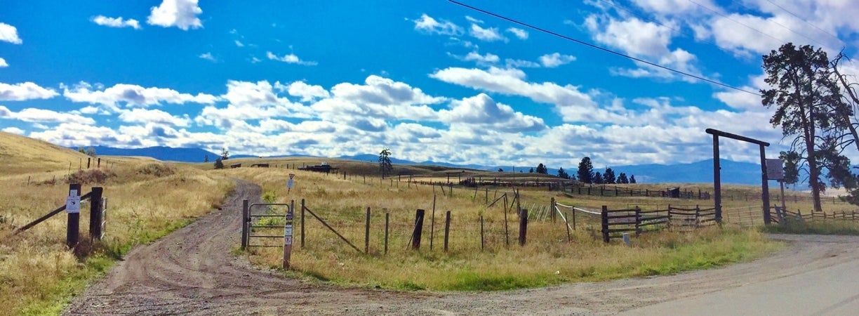
This trail is a very scenic and historical piece of land in the Okanagan Valley. The Princeton area was opened by explorers, fur traders, miners and later by the Kettle Valley Railway. Many of these trails were built along routes first used by Native Canadians. Many of the Heritage Trails can still be hiked or ridden on horseback. The Princeton portion is one of the most picturesque sections. The trail runs from Brookmere southeast to Princeton and then northeast from Princeton to Bankeir and the Three Lakes, a distance of 113 kilometres or 70 miles. Princeton is at the centre and lowest point of elevation on the trail, making it a perfect base camp for your ride.
Highlights along the way include Otter Lake, with excellent swimming beaches; the Village of Tulameen with accommodation, restaurant and general store; Historic Coalmont and the Coalmont Hotel; Tulameen River canyon; Trestles and tunnels, site of the Kettle Valley Railway's last spike and the last bridge built (now known as the Bridge of Dreams).
Follow the footsteps of the explorers along the original Hudson’s Bay Company Fur Brigade Trail between Hope, BC and Princeton. The original fur trader campsites can still be found 25 to 40 kilometres apart. Other Heritage Trails include the 1858 Whatcom gold rush trail and the Dewdney Trail. Visitors may explore half a dozen mining ghost towns.
Trapper lake is located in southern B.C. near the Canada/U.S. border, west of Cathedral Provincial park. It is in a beautiful alpine setting near timberline. There is lots of grass and water for horses, good fishing, and it is mostly level around the lake. To get there, turn off Highway 3 at Copper Creek, a few kilometres from the eastern boundary of Manning Park. Travel on the Placer Mountain forest service road for about 2 or 3 kilometres from Placer Lake. This road is fairly wide until the last few kilometres and is easily traveled with a horse trailer. It is a mountain road used by logging trucks, so check your brakes before leaving home and keep a close watch for trucks. The last part of the road to the lake is not suitable for horse trailers. There are several places to park your rig by the roadside as you approach Placer lake, including a good campsite alongside Placer Creek.
Access to some good riding country can be had from the Whipsaw Creek Forestry Road. This road circles back to Coalmont, becoming the Granite Road sometime after it passes Paddy's Pond. It is only suitable for horse trailers for the first 23 km or so from Hwy 3. Nearby or connecting trails are Hope Pass Trail & Dewdney Trail. The Hope Pass trail divides into two branches before it meets the road, thus you will see Hope Pass Trail shown in 2 locations on the Google Earth map. One of the branches meets the Whipsaw Granite road at Dick's Cabin, the other just a few minutes ride from Corral Creek camp. The Dewdney Trail crosses the road at Paddy's Pond, and continues to meet another road which branches to the left from the Whipsaw Road at km 18, where there is a sign "Granite"-- yet another Granite Road to be confused by! There is rustic camping at Corral Creek & many other locations. Corral Creek has an old outhouse.
The Snowy Mountain Loop Trail is one of the very best trails in BC. It makes for a six day ride encompassing the arid south central climate, high alpine lakes and sub-alpine open slopes. It has steep inclines and a few boggy sections, and should be considered as suitable for experienced riders, and not suitable for novices. Experienced guide recommended. The feed is fair, the fish numerous and the scenery spectacular. There is more than one route to follow and in most sections the longer perimeter trail is quite evident. A map, compass and GPS should be considered as required.
The Ewart Creek trailhead is located on the Ashnola River. You can park here or follow the single lane and somewhat narrow road for 2 km to the actual trail head. There are two corrals and a long line of hitch'n posts here as well as an out house.
The trail leads from there, crosses over Ewart Creek and heads south on its eastern bank. The trail crosses back over the creek and then branches. Go left which takes you onto the south slopes of the protected area. There is no trail map available of the area but this trail does lead up above the tree line. Remember this is pure wilderness with no facilities. The trails within this area are not marked or maintained. There are a number of cabins in this Protected Area but only the back country cabin at Joe Lake is open to the public. All other cabins are either for approved permitted guide outfitters or the First Nations. At these cabins, users could encounter outfitters or back country cowboys hunting, guiding or cattle grazing.

Manning Park offers many trails for horseback into the backcountry wilderness including two backcountry horse camps. Trails include the following:
- Monument 83
- Dewdney
- Windy Joe
- Poland Lake
- Skagit Bluffs
- Silmikameen East and West
- North Gibson
- Little Muddy
- Hope Pass
- South Gibson
Horse Camping is available at the Headwaters Corral located at Manning Park Resort, also back country horse camps are available on the Dewdney and Hope Pass trails. Horse camps include a toilet, fire ring, water, hitching rail and grazing.
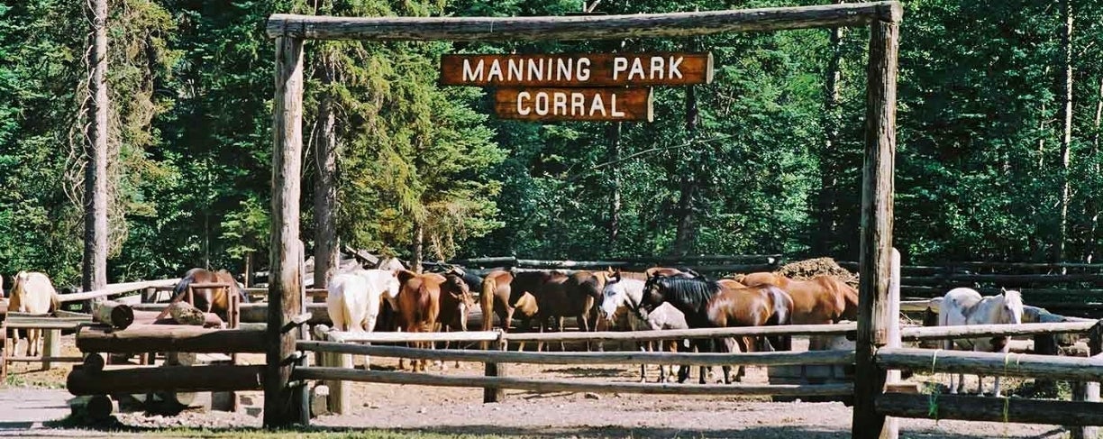
What was once a dream has become a reality! The Headwaters Corral Equestrian Campsite in E.C. Manning Park was officially opened on July 30, 2011. A lot of things came together to make it a special day. Not only was it the realization of a three year long dream, it was also a celebration of BC Parks’ 100th Anniversary and Back Country Horsemen’s ( BCHBC) 20th Anniversary.
The campsite is located just off Highway #3 midway through E.C. Manning Provincial Park on the Gibson Pass/Lightening Lakes road. The site was once a commercial trail riding stable but has been converted by the Yarrow and Aldergrove Chapters of BCHBC into a 6 site equestrian campground connected to trails. Permission was obtained from BC Parks for the project. A partnership and MOU (memorandum of understanding) was formed between BC Parks, Manning Park Resort, and BCHBC. To prevent any loose stock from getting out on the roadway or disappearing into the mountains, a perimeter fence and ranch style gateway was established.
This is a rustic campsite that, for now, has a “first come, first serve policy". Facilities include individual and double back-in sites, highlining posts and trees, a pit toilet, a manure collection bin, a central fire pit, and a water tap. A short hike up to the resort provides campers with the options of a restaurant, showers, an indoor pool, a hot tub, workout facilities, a sauna, a pub, and a country store.
This is a Provincial Campground like any other, so camping fees apply. Currently there are no corrals for housing stock. The preferred method is by highlining or bringing your own panels. There are also guidelines for feeding stock while in a Provincial Park to keep our beautiful BC Parks weed free. Remember that there are many miles of front and back country trails in Manning Park, so to stay safe and protect our “Right to Ride,” please check and ride only on those trails designated for horse use.
Funding was needed to hire a contractor with the right equipment to build the circular driveway and back-in sites. Horse Council BC and their BC Equestrian Trails Fund have supplied the majority of the funding, along with the Yarrow and Fraser Valley Chapters of BCHBC, the Hope Riding Club, TD Canada Trust, Tamahi Logging, and private donations. Generous donations were also made by BC Parks, Manning Park Resort, Super Save Disposal, Emil Anderson Highway Contractors, and West Bridge Corporation.
Hope Pass Backcountry TrailCaptain Grant constructed this heritage trail in 1861 to 1862 on the request of the Royal Engineers. The trail commences at Cayuse Flats parking lot elevation 850 m, 25 km west of the Manning Park Visitor Centre or 17 km east of the west portal and ends at Dick's Cabin. Trail Length is 23.5 km with an elevation change of 1000 m. After leaving the parking lot, one follows the Skaist River in a northerly direction. At approximately 6 km the trail crosses Grainger Creek where Grainger Creek horse camp is located. There is no grazing available at this horse camp. The Grainger Creek Trail, which is a hiking trail only, travels east to Nicomen Lake. Once you have crossed Grainger Creek you are in the Cascade Recreation Area. Continuing along the Skaist River, the Hope Pass Trail goes through some fairly heavy timber and crosses various creeks. A few kilometres past Grainger Creek you may see signs of a Mountain Beaver Colony and further up the trail keep your eyes open for waterfalls on the west side. Water is plentiful on this trail year round. Km 19 brings you to a viewpoint as well as hitching rails and benches. Skaist Mountain to the north at 22 km is 1950 m. in elevation. Marmot City is located just below Hope Pass and is the location of yet another horse camp (Marmot City horse camp). This camp has limited water and feed during the later part of a hot summer. The Hope Pass, elevation 1839 m, is the divide of the Whipsaw Creek and Skaist River. From Marmot City you can travel north a further 1.5k m to Dick's Cabin or continue in an easterly direction along the Hope Pass Trail and down Whipsaw Creek on a 24 km logging road. From Dick's Cabin you can return the way you came or follow the Dewdney Trail west to the Cascade Recreation parking lot via Paradise Valley, a distance of 36 km, and then take the Skagit Bluff Trail to Cayuse Flats. The Skagit Bluff Trail is 5.6 km.
Skagit Bluffs TrailThe Skagit Bluff Trail is a connector trail between the Dewdney Trail and Hope Pass Trail. The best time to go is between June and October. Red Rhododendrons bloom mid June. The Skagit Bluffs Trail parallels the Hope Princeton Highway between the Cascade Recreation Area parking lot and Cayuse Flats parking lot. As the trail rises above the road, the rider is rewarded with occasional good views. Little traffic noise is heard as the trail climbs and heads deeper into the forest on a trail that is often softly padded with needles from the trees towering overhead. For a good stretch of this trail you will actually be riding along the old Dewdney Trail which is part of, or parallel to, today’s Hope Princeton Highway. The Dewdney is a heritage trail that was constructed in 1860 by Edgar Dewdney on the request of Governor Douglas. This trail was originally called "Mule Road to the Similkameen" and later known as the "Canyon Trail".
Cascade Recreation Area parking lot start: The trail commences within 50 m of the entrance to the parking lot. You will need to drive into the parking area and backtrack along the driveway to the posted trail head. The elevation gain begins almost immediately. For the first 10 minutes the trail skirts along and gradually rises above the highway. You will soon begin to notice an abundance of Red Rhododendrons. These shrubs put on a spectacular display around mid-June. The trail levels out for about 100 m and then starts to climb. A further 15 minutes of uphill will bring you to a rock slide area. This slide area continues for a few hundred metres. After this the trail descends for a brief minutes break and then starts a brief and easy uphill climb (30-35 minutes from the trail head).
Continuing along, the trail starts to descend and reaches the first creek crossing which is dry in summer and even into early September. The next creek is reached about 2 minutes later and generally has plenty of water. A further 200 m brings you to the 3rd creek crossing, which while not as full, will probably have water in the summer and early fall providing the summer has not been too hot and dry. You then begin a slight ascent which gradually becomes more strenuous but only for a short time and then begins to descend to a fairly strong large creek which is a good supply of water (about 45-50 minutes along the trail). This creek is not bridged so caution must be used in crossing it. At this point the trail is rolling along up and down, and then ascends for a short distance (1 minute) and for the next 10-15 minutes you can enjoy a more or less downhill journey.
Windy Joe Back Country Trail Manning
Located inside Manning Park, Windy Joe Mountain was named after Joe Hilton, a local pioneer trapper who often remarked that the top of this mountain was so windy that it was kept snow free. The summit of Windy Joe offers great views of the surrounding area, as well as a chance to see sub alpine flowers during mid July. The trail can be muddy during the June to mid July run off. Trail length is 7.5 km one way with an elevation change of 525 meters.
The trail commences at the Windy Joe/PCT/Canyon Nature Trailhead, located 1 km off Hwy 3 on the Gibson Pass (Lightning Lake) Road. It heads southeast along the Similkameen Trail for just over 2 km before intersecting the Windy Joe trail. As you travel along the first part of the trail, keep your eyes open for birds. Many species can be seen along here, especially if you begin your hike early in the morning. The trail, which begins its climb here, is an old access road that was previously used to transport people and goods to the fire lookout at the summit. At approximately 3.5 km you will cross a small stream, which is a good spot to stop for a rest and fill your water bottles. A few minutes after passing a second creek you will get your first view of Frosty Mountain, the highest peak in the park (2408 m). In another fifteen minutes, the trail forks (5.5 km), and as indicated by the sign, the left fork continues on to the top of Windy Joe. The right fork is the Frosty Mountain trail which also branches off to the Pacific Crest Trail. The Pacific Crest Trail, which heads south to the Canada - U.S. border, has a wilderness campsite about 20 minutes from the fork. Just metres prior to the summit of Windy Joe, you will notice a large piece of rock at the side of the trail. These conglomerate rocks may be seen in several areas of the park and were left by retreating glaciers during the last ice age.
After an invigorating 2.5 hour ride, the summit is reached at an elevation of 1825 m. At the top there are numerous things to look for. The most obvious, is an old Forest Service fire lookout tower that has been refurbished with an interpretive display of the fire lookout and the surrounding features. The lookout has not been used since 1965, but still offers a magnificent panoramic view, from Frosty Mountain to Blackwall Mountain. Alpine Fir and White-bark Pine abound; the firs have purplish cones which disintegrate on the tree during the winter, and leave only the central spires sticking straight up on the top branches. White-bark Pine have smooth, pale-grey bark and needles in bunches of five. An outhouse is available just before the summit, but it may be necessary for you to take your own toilet paper.
Poland Lake Back Country Trail
Poland Lake freezes over in the winter and does not thaw out until early July. The spring flower bloom often occurs later here than up in the sub alpine meadows, so it is an opportunity to see spring flowers that are often otherwise missed. Although this trail primarily skirts alongside the mountains and not through large meadow areas, there are incredible floral displays throughout the route. Trail Length is 16 km return (to lake) with an elevation change of 435 metres.
Best Time to Go: Late June to early October. Follow Highway #3 (Hope-Princeton Highway) 67 km east of Hope to the intersection with a flashing amber light just past the Manning Park Lodge. Turn right onto the road and follow it for 8 km to the Strawberry Flats parking lot, located just before the Gibsons Pass ski area.
For the most part, the trail is a fire access road. The trail is level for about .5 km and then gradually starts to climb. At .8 km there is a creek, but the remainder of the hike to the lake will be dry. At 1 km Red Mountain is visible through the Lodgepole Pine. The trail gradually veers away from Gibson Pass Road and climbs more steeply to the ski hill. Once you reach the ski run area (just before the orange chair) the route varies. Hikers go to the left and cross under the chair lift; cyclists and those on horseback stay to the right keeping on the fire access road which makes several switch backs and comes out at the top of the orange chair then continues to the 4.5 km point where the two routes join. Cyclists and horses are only permitted to travel to the end of the road.
A true wilderness experience, Cathedral Park comprises an expanse of jagged mountain peaks, azure lakes and flower dappled alpine meadows that is definitely for the adventurous. Located between the dense, wet forests of the Cascade Mountains and the desert-like Okanagan Valley, this mountainous park offers a rich variety of terrain, flora and fauna. Fascinating rock formations, including a jumble of columnar-jointed basalt forms and massive, wind-eroded quartz monzonite towers, make this an excellent spot for the experienced hiker. The lakes in the park look like turquoise jewels in a granite setting. Each of the close-knit group of lakes, Quinsicoe, Ladyslipper, Scout, Pyramid, Glacier, and Lake of the Woods, has a unique charm. Equally as beautiful are the tranquil Haystack Lakes, which are within a day's hike of the main lake areas.
Horseback riding is only authorized by letter of permission into Twin Buttes and Haystack Lakes. To obtain a letter of permission, contact the Okanagan Region at:
Parks and Protected Areas Section
Environmental Stewardship Division
Telephone: (250) 490-8200
There is no camping at the lakes, only at Twin Buttes. Maximum group size is four people and six horses and the maximum stay is three nights. Users must bring pelletized feed and hobble and move their horses regularly to prevent overgrazing and trampling. Access to Snowy Protected Area from Ewart Creek to the Juniper Creek junction is permitted with no letter required. The Core Area is closed to horses.
Bound on the south by the British Columbia-Washington State border, on the east by Ewart Creek, and on the west and north by the Ashnola River, Cathedral Park is approx. 30 km southwest of Keremeos and 48 km (30 mi) south of Princeton.
